
Topographical & Engineering Surveys

Our topographical and engineering survey service provides the accurate spatial data needed for sound project planning and design. We map terrain, measure features, and document site conditions using advanced survey tools, helping clients build infrastructure that aligns with real world constraints.
Through detailed measurement, elevation mapping, and physical site assessment, we support engineers and planners with reliable information for design and construction. Our surveys reduce uncertainty, improve project accuracy, and create a strong foundation for safe and efficient development.
High Measurement Accuracy
Advanced survey tools that deliver precise spatial data and reduce uncertainty in engineering design.
Reliable Terrain Mapping
Detailed topographical capture that supports effective planning for new or upgraded infrastructure.
Reduced Design Risk
Accurate site data that helps prevent construction errors and costly project adjustments.
Clear Project Planning Insight
Survey outputs that guide practical design solutions and improve overall project efficiency.
Improved Construction Accuracy
Data that supports precise implementation during excavation, earthworks, and site layout.
Strong Data Integration
Seamless survey information that works with design software for smoother project coordination.

Key Benefits

Whether you’re embarking on a new construction project or seeking to optimize an existing one, choosing the right partner is crucial. We bring a wealth of experience and expertise to every project. Here are the six key benefits you’ll gain by working with us:
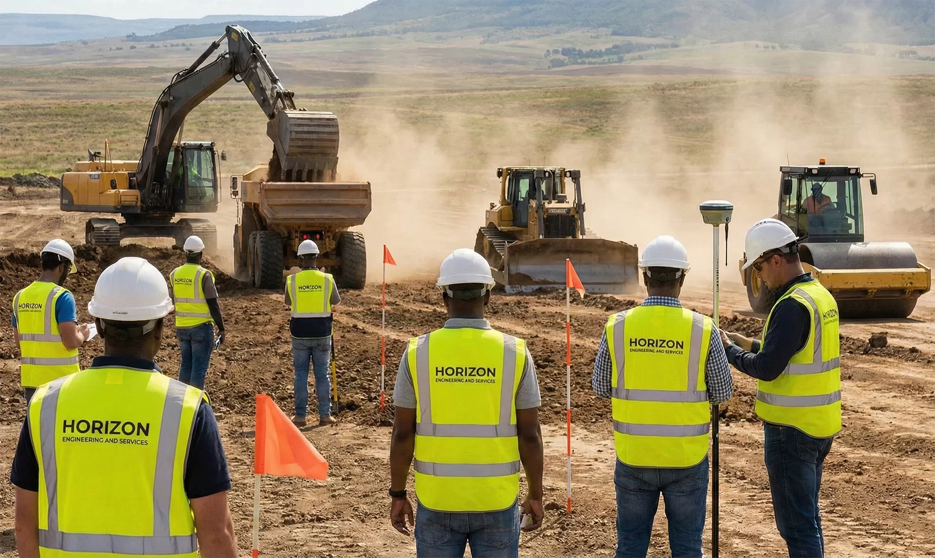
A diverse, multiracial team of engineers wearing high-visibility vests marked only with the text "HORIZON ENGINEERING AND SERVICES" use survey equipment to observe heavy earthmoving machinery, including an excavator, bulldozer, and roller, on a large dusty construction site in Kolwezi, DR Congo.
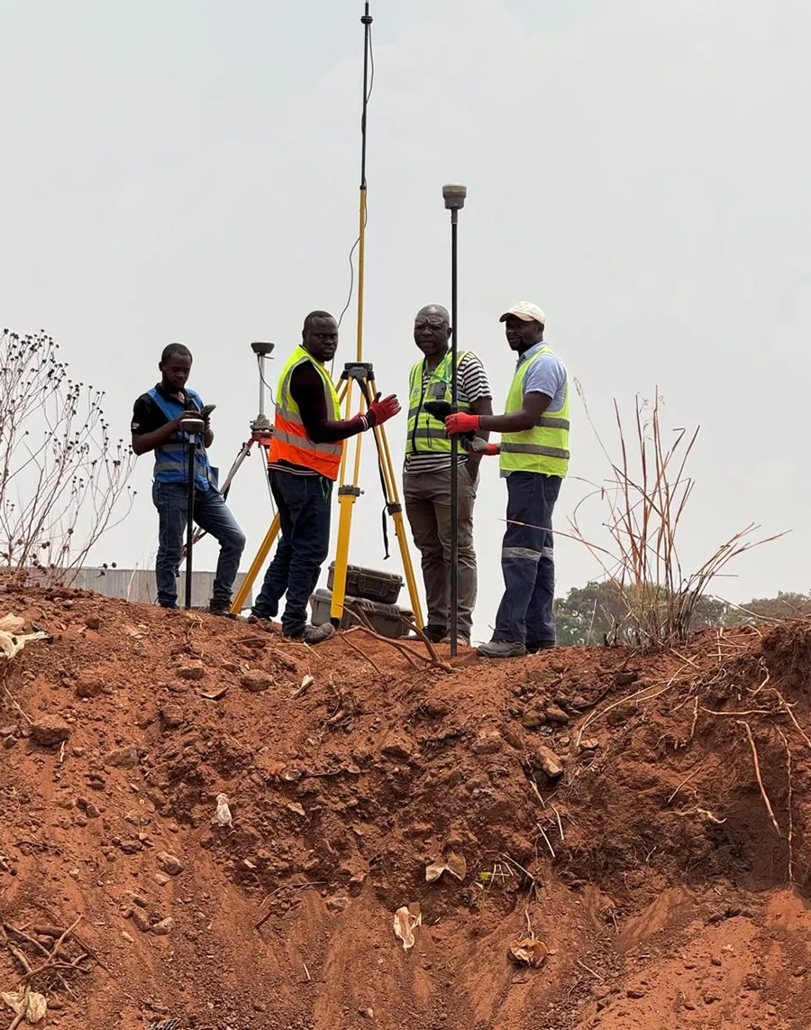
A team of four surveyors from Horizon Engineering and Services, wearing high-visibility vests, use GNSS receivers and tripods atop a large mound of red earth at a construction site in Kolwezi, DR Congo.

What We Offer

Our topographical and engineering surveys provide essential data for safe and accurate infrastructure development. We capture detailed site information through precise mapping, elevation measurement, and structural assessment, helping clients reduce project risks and plan with confidence from the earliest stages.
Topographical Mapping
Comprehensive measurement of natural and man made site features, including terrain shape, ground elevations, waterways, and built structures. This data supports road design, building placement, earthworks planning, and infrastructure layout by providing a clear understanding of physical site conditions.
Engineering Control Surveys
Establishment of horizontal and vertical control points that guide precise construction and design work. We ensure projects are aligned correctly by creating reference systems that support accurate layout, structure positioning, and long term monitoring of engineering works.
Construction Set Out Surveys
Survey services that mark the exact location of structures, roads, utilities, and excavation limits before construction begins. Our work ensures contractors build according to design specifications, reducing errors, rework, and alignment issues during active site operations.
As Built Verification Surveys
Measurement of completed works to confirm that construction aligns with approved designs. We document final positions, elevations, and dimensions, providing accurate records for compliance, quality assurance, and future maintenance or upgrade planning
Digital Terrain Modeling
Creation of 3D digital terrain models that represent elevation changes, slopes, and landscape features. These models support engineering design, hydrological studies, and long term planning by providing clear insight into site behavior and development potential.
Utility and Infrastructure Surveys
Mapping of underground and above ground utilities such as pipelines, cables, and drainage structures. We help reduce construction risks by identifying asset locations, preventing damage, and ensuring new infrastructure integrates safely with existing services.
Schedule a Free Consultation